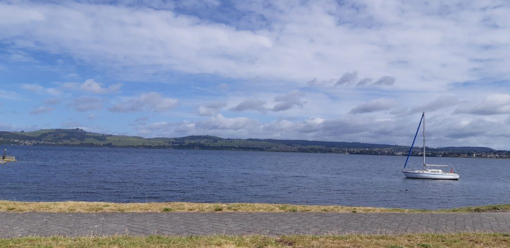
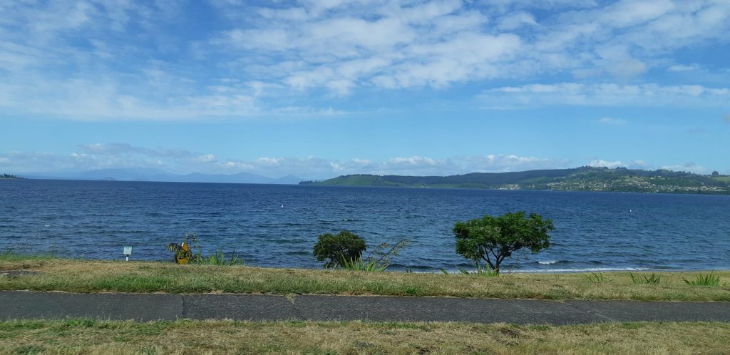
We left Turangi and drove along Lake Taupo. It was formed out of an eruption of a supervolcano some 26.500 years ago. The eruption was given a name: Oruani. The lake has a surface of 616 km² and a depth of 186 m. The circumference of the lake is 193km, making it the biggest lake in New Zealand. It lies in the crater of the volcano. There are two islands on the lake, the biggest is the Motutaika Island with 11ha.
You can rent kayaks or go on a boat tour to Mine Bay to see Maori rock carvings. You can also go trout fishing. Close by are the Tokaanu Thermal Pools which are open to the public and an ideal place to relax.
We spent some time walking along the lakeside and admired the beautiful views. The first impression is that it is not a volcanic lake.
We continued heading toward Rotorua. On the way, we stopped at the Huka Falls. These are located on the Waikato River. It is New Zealand’s longest river (425 km). The source is Mount Ruapehu in the south. It then flows through Lake Taupo and continues until it flows into the Tasman Sea, just south of Auckland.
The spectacularly beautiful Huka Falls are the strongest in the country. They are “only” eleven meters high. But the water plunges with a force of 220m3 per second. At the top of the falls, the width of the river is 100m and after, it flows into a canyon that is only 15m wide. This explains why the falls are so powerful. This too is a result of the Oruani eruption.
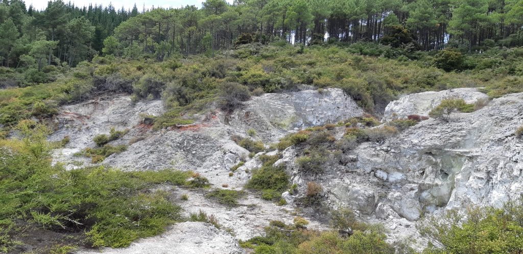
After admiring this powerful natural spectacle, we continued to Wai-O-Tapu Geo-Thermal Wonderland.
Our first impression was the contrast between the green of the vegetation and the rocks and minerals which seem to be alive. The smell of sulphur was extremely strong, and it accompanies you for the entire time of your visit. It is the smell of rotten eggs.
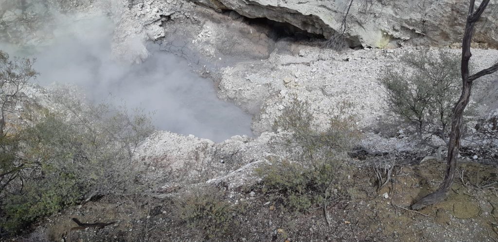
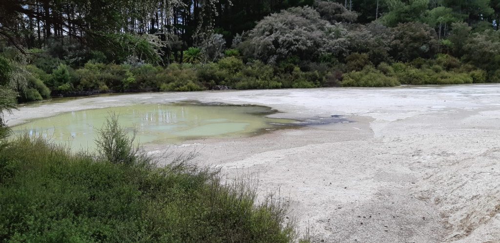
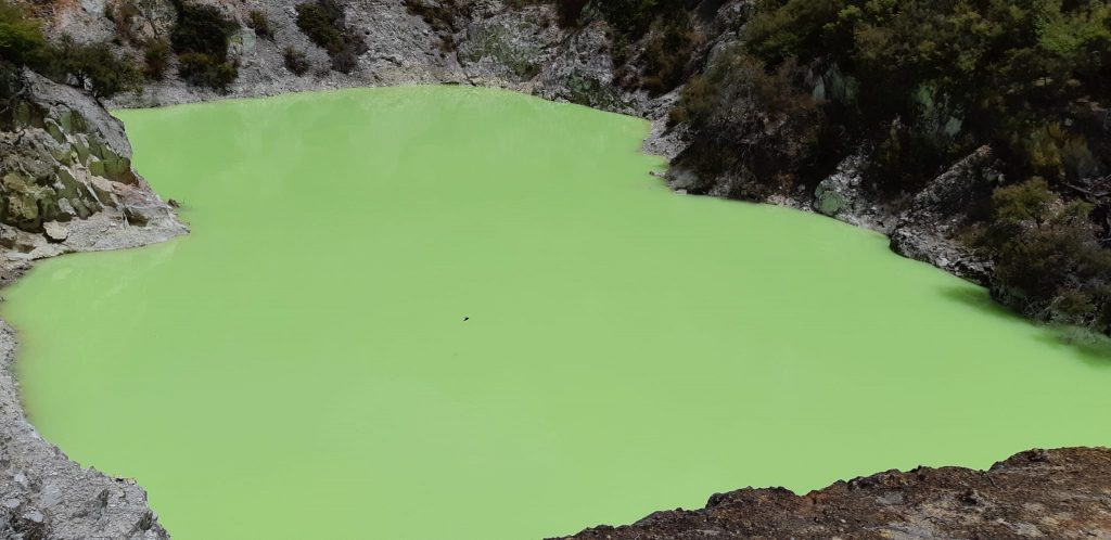
There is an area called the Champagne Pool. The bubbles and the colour of the water are a reminder of this drink.
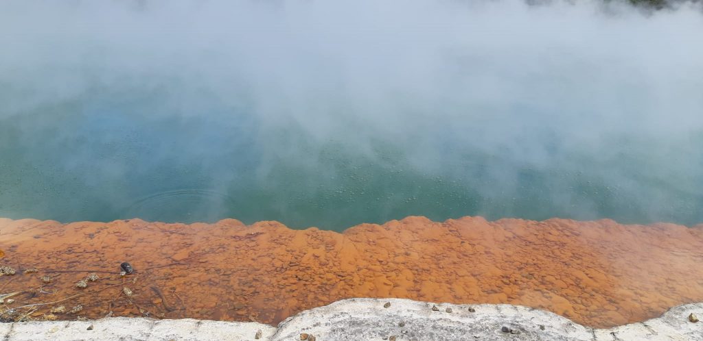
The colours were always very beautiful.
There is the Pohutu Geyser and the Wairakei Terraces. (The natural thermal valley Taupo).
We cannot leave this area without mentioning the volcanos, in the Tongariro National Park. This is a volcano range.
The most southern volcano is Mount Ruapehu which is 2797m high. It erupted in 1959 & 2007. There was an earthquake which lasted 8 minutes.
On the 24.12. 1953 there was also an eruption. Lava flowed down into the Whangaehu River, minutes before an express train approached the bridge at Tangiwai. The timing of this accident added to the sense of tragedy. 151 passengers lost their lives.
Mount Ngauruhoe, 2287m high, has the highest “eruptive mouth” of the Tongariro Volcano Range.
There is one beautiful thing that was destroyed in June 1886 with an eruption of Mount Tarawera. These were the pink and white terraces. Before they were destroyed, they were a tourist attraction and people called them the 8th wonder of the world.
Visiting the Tongairo National Park is a must. (This is the crater lookout). But be prepared for a short-term cancellation, as happened to us, if the weather is bad.
We stayed in Rotorua for two nights.